
Walk a Mercer Street by Address
A Mercer street directory search is parcel-first. Move along the street in address order and keep a separate entry for every parcel. Start by standardizing each address and confirming the municipality, since a postal city label can cross a municipal boundary. Then record the street address, ZIP used for delivery, municipality, block, lot, qualifier or PIN, parcel situs, tax-bill mailing address when available, and the source year. The parcel key is more dependable than a street number when a document uses a legal description.
The public map can locate a parcel and the surrounding tax blocks. The Clerk’s index then provides the recorded-document layer. A property owner, a tax mailing address, a document party, and a person associated with a voter record are not interchangeable fields. Describe each one as a source association and preserve the date, rather than labeling it as proof of present residence.
- Use the state municipality lookup to standardize the street address and confirm the responsible Mercer municipality.
- Search NJ Property Explorer by address, county, municipality, or block/lot and record the parcel key.
- Use the map and parcel or tax-block layers to continue to adjoining street addresses.
- Search Mercer Official Records by town plus lot/block, legal description, or the owner name in last-name-first format.
- Use a municipal assessor, clerk, or focused OPRA request for a non-posted local record such as a property card or address-date permit log.
Standardize Mercer Street Addresses
Mercer has 12 municipalities. The city on a mailing label and its ZIP can differ from the taxing municipality that keeps the assessor, zoning, clerk, or permit record. The state address tool is the first check before a by-street search. It accepts Street Address, City, State, and an optional ZIP, then returns a standardized format and municipality. Carry that municipal result into the parcel and Clerk search instead of assuming that a Trenton, Princeton, Hamilton, or other postal label settles the question.
The New Jersey Municipality Address Lookup shows the official address-standardization form.
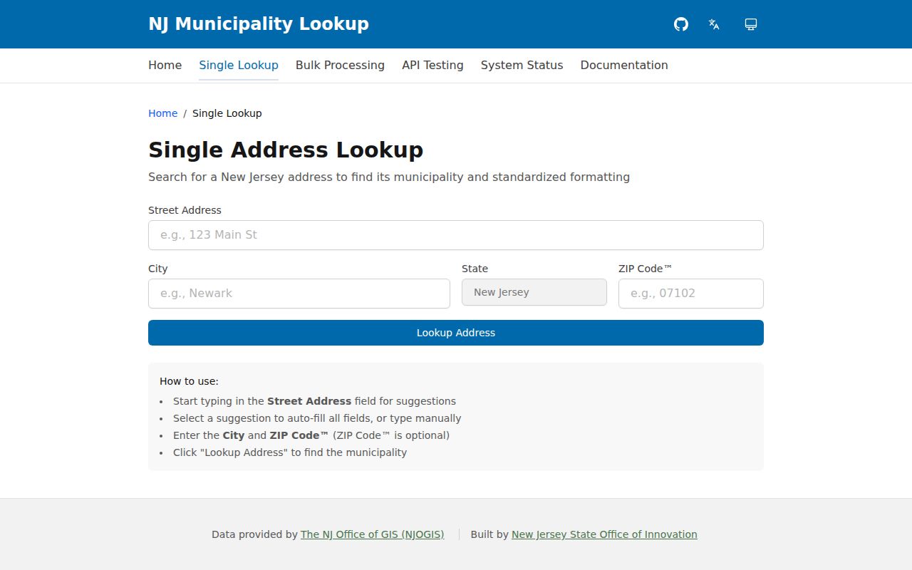
For delivery verification, run the complete address through the official USPS lookup. A ZIP is delivery geography, not municipal proof. The same distinction protects a street search from being sent to the wrong municipal custodian or applied to the wrong tax district.
Mercer Parcel Map and PIP Limits
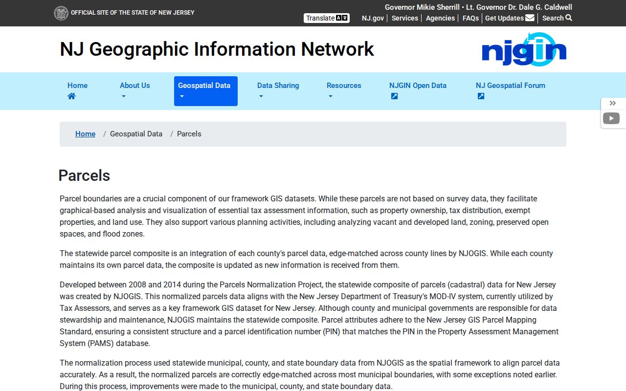
NJ Property Explorer and NJGIN are the public map route for a Mercer address. They support searching by address, county, municipality, and block/lot, then viewing parcel and tax-block layers. Click a parcel to retain its geometry and available attributes. Public state-hosted parcel data is useful for visual location, PIN alignment, and tax context, but it is not survey data or a legal boundary determination.
The NJGIN Mercer parcels page explains the state parcel layers and their limits.
Mercer’s County Property Information Portal is closed to ordinary public users because of Daniel’s Law. It is not a fallback for an owner-name search. Owner names are also redacted from the hosted NJGIN parcel and tax-list downloads. Where a public layer omits an owner field, retain the municipality and block/lot, then use the Clerk’s deed index or the municipal assessor and OPRA route.
Search Mercer Deeds From a Street
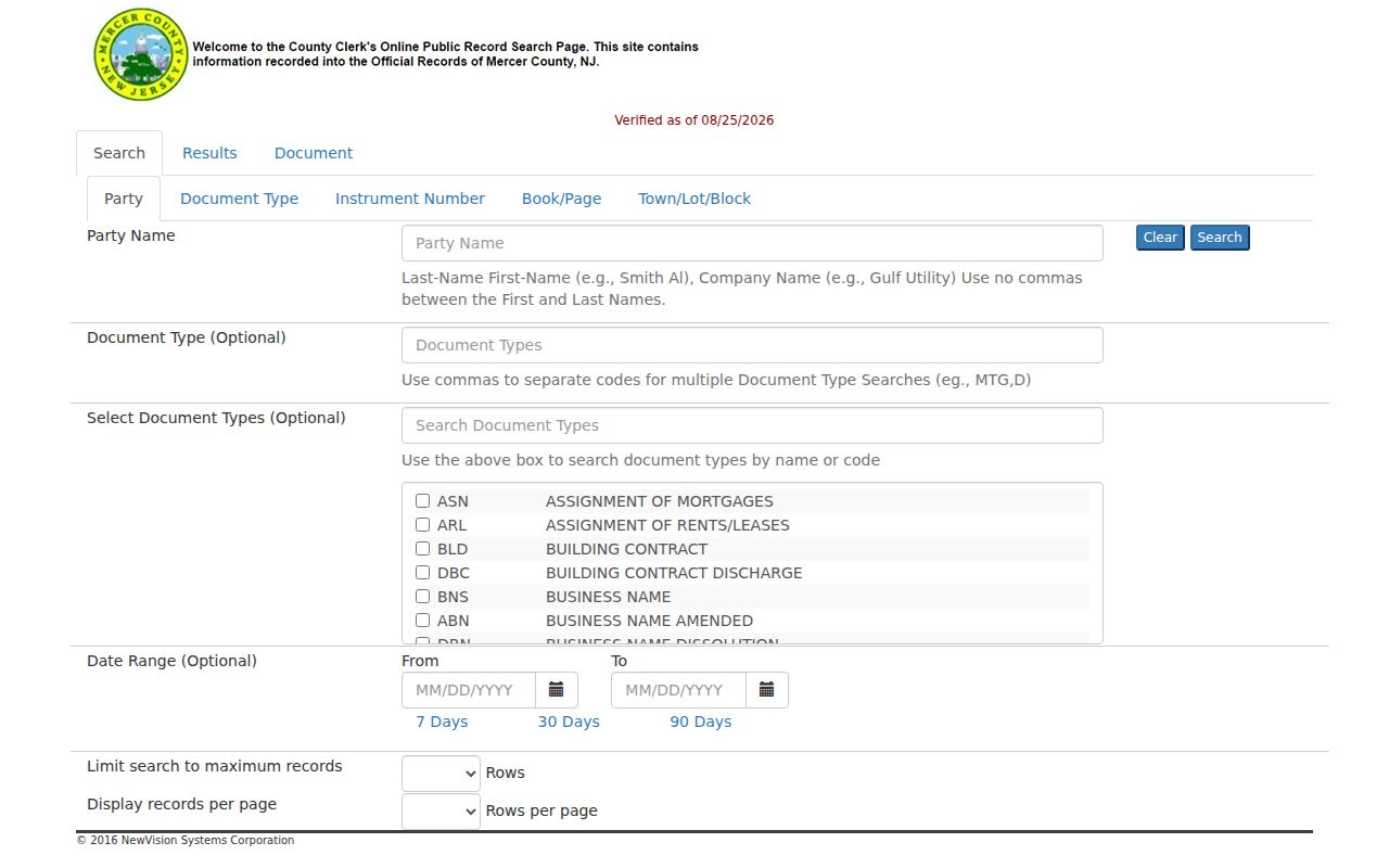
Mercer Official Records has three useful bridges from a street address to a recorded document: Town plus Lot/Block, Legal Description Line 1, and Party Name with a date or document-type filter. The street wording itself may not be the best key. Use the legal description or parcel identifiers from a map, tax record, or prior deed to separate similar names and nearby lots. When party search is needed, enter the name last-name first with no comma and try documented variants separately.
The Mercer Official Records public search displays the address, legal, party, and document paths.
A document detail can display type, instrument number, recording date/time, book/page, pages, consideration, legal text, linked documents, and referring documents. Record the grantor and grantee separately. A grantor transfers an interest and a grantee receives it. A trust, estate, business, or attorney may be the named party, so the entry is evidence of a document role rather than a complete roster for the street.
| Official Records field | Street-search use |
|---|---|
| Town | Choose the confirmed Mercer municipality |
| Lot / Block | Retrieve the parcel’s legal tax identifiers |
| Legal Description Line 1 | Use stable wording from a prior deed or plat |
| Party Name | Search a known document party in last-name-first form |
| Document Type and date | Narrow a broad set of recorded transfers, liens, or mortgages |
Mercer Street Directory Record Layers
Address-keyed sources overlap, but they do not answer the same question. Use the map and tax record to identify a parcel. Use the recorded index for legal transfers. Use municipal files for locally held permits or property cards. The voter route is a controlled request channel, not a street-wide public web search. Keeping the source in its own column makes a street-by-street result more defensible.
| Address-keyed source | What it shows | Mercer access route | Important limit |
|---|---|---|---|
| State tax and property layer | Location, block/lot, assessment, prior-year tax, class, and owner when available | Property Explorer; municipal assessor | Annual list may lag a later deed |
| NJGIN parcel map | Parcel geometry, PIN, block/lot, tax-block context | State public map and data page | Owner names redacted; not a survey |
| Official Records | Recorded parties, documents, dates, consideration, legal description | Public search, Records Room, written copy request | Document party is not an occupancy field |
| Municipal permit or zoning file | Address, project, applicant or owner where released, review or final status | Town counter, phone route, or targeted OPRA | Online availability varies by municipality |
| Mercer voter file | Fields permitted by law in the requested format | OPRA request to Superintendent of Elections | No public street-wide web list |
For a transfer date, the Clerk’s recorded document is the stronger source than an annual tax record. For a map location, NJGIN is the clearer visual layer. Use each source for its own field rather than trying to make one source answer every question.
Mercer Voter File Requests by Area
The public New Jersey voter tool is person-first. It requires first name, last name, and birth month/year, so it is not designed to search a street. A fuller voter list is requested from Mercer’s Superintendent of Elections under OPRA. State the municipality, ward or district if known, date range, requested format, and the specific record. Include the county’s required statement that the material will not be used for commercial purposes.
Lawful voter-list formats may include permitted name, address, party, ward, district, and participation fields, but ballot choices are not public. ACP and Daniel’s Law protections can remove or replace addresses. The county’s public voter-registration page does not publish one current fee for every list format, so confirm the charge with the custodian before ordering. A missing name or a protected address should never be treated as proof that no person is connected with the street.
Mercer Permit Trails by Street
Permits and code cases belong to the municipality where the address sits. Trenton’s Division of Inspections identifies building, electrical, plumbing, fire protection, elevator, zoning, use, occupancy, maintenance, and land-use activity. Its public information gives phone routes for permit availability, plan requirements, and plan status, but does not expose an online address-name permit search. Other Mercer municipalities may use different software or counter files.
When a permit is not online, ask the municipal custodian for a specifically described permit register, certificate of occupancy, inspection report, or zoning decision by address and date range. An address permit can establish that a project was applied for or completed and can identify a released applicant or owner. It does not establish every person connected with the location.
Mercer Records Room Street Fallback
The online index does not eliminate the counter route. The Clerk’s public Records Room at 209 South Broad Street has maps for all 12 municipalities and minor and major subdivision maps. It is open weekdays from 8:30 a.m. to 4:30 p.m., with extended Wednesday hours listed by the Clerk. The index can return only the first 10,000 results for a broad search, so narrowing by date, document type, legal wording, or parcel key can make an address query workable.
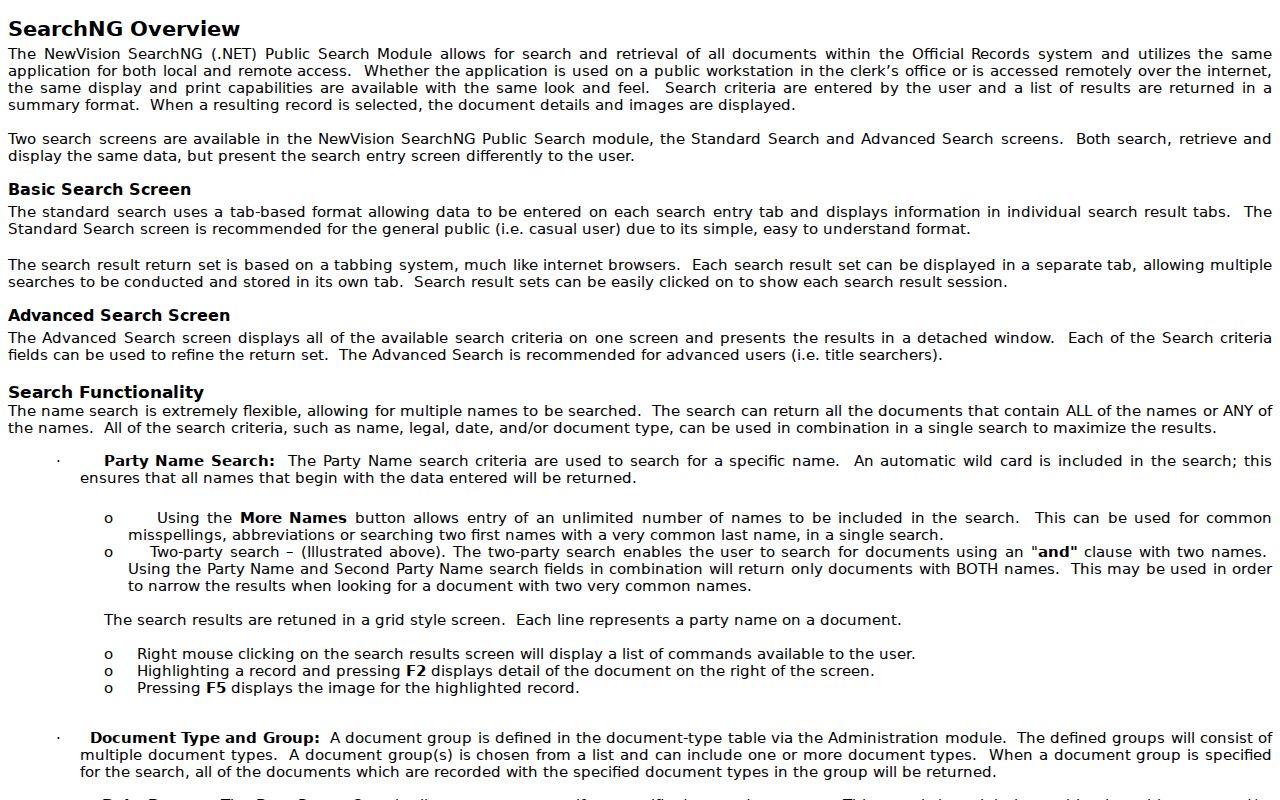
The NewVision SearchNG help page describes Standard and Advanced Search, legal and map search, sorting, available images, and public-workstation behavior.
For a missing image or a document outside the practical online run, ask about older index books, maps, and copy options. The Clerk’s pages distinguish copy fulfillment from recording charges, so confirm the current copy method and amount before a written request.
Mercer Street Records Defined
Using the same terms across a street worksheet prevents a map label, mailing destination, and legal parcel description from being confused. Record what the document says, then carry the most stable identifier forward to the next source.
- Parcel
- A piece of land represented in a tax and map system, commonly tied to a block, lot, qualifier, or PIN.
- Situs address
- The physical location of the parcel. It can differ from the tax-bill mailing address.
- Plat
- A recorded map that can show a subdivision, lot layout, street, or other legal land description.
- Criss-cross directory
- An address-oriented street list, unlike a regular alphabetical directory. Its availability must be checked with the holding collection.
Compare Mercer Street Record Dates
Different street records update on different schedules. The annual state property layer reflects the tax list filed in January. A transfer recorded after that filing can appear in the Clerk’s deed index before the tax layer changes. Map geometry gives location context, but it is not a title opinion. The strongest address file keeps the tax-list year, recording date, and source name side by side.
| Need | Best Mercer source | Read it as |
|---|---|---|
| Parcel and assessment context | Property Explorer or municipal assessor | An annual tax record with its stated vintage |
| Transfer sequence | Mercer Official Records | A recorded document chain by legal description or block/lot |
| Parcel placement along a street | NJGIN map and tax-block layers | Map context, not a legal survey boundary |
Limits of a Mercer Street Directory
A street search can show parcel, tax, map, recorded-document, and municipal-record associations. It cannot identify every individual connected with an address. Tax mailing addresses can be an office, trust, agent, or another location. Public property records and permits do not create a complete household list. Motor-vehicle personal information is restricted, and utility and delivery records are not public resident lists. Protected voter and confidential-address programs also limit release.
Historical street entries have their own limits. A Trenton directory or a street list can be useful for a dated address clue, but its notation must be read in the context of that edition. The city-directory collections are kept separately on the Mercer City Directories page, while this by-address route remains focused on current parcel and local-record chains.